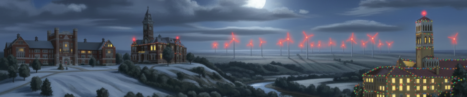
Northwest Missouri Regional Airport is a city-owned, public-use general aviation facility located two nautical miles west of Maryville in Nodaway County, Missouri. [1]
Key History and Timeline
- Post-World War II Establishment: The original landing strip was built just after World War II as Maryville Memorial Airport to serve local hobby pilots and agricultural aviation. [1]
- Ownership and Operations: The airport has historically been operated and managed by the City of Maryville alongside a local airport board, with past management involving local aviation operators like the Rankin family. [1, 2]
- Rebranding (2003): The facility was officially renamed Northwest Missouri Regional Airport in 2003. [1]
- Facility Upgrades (2007): A new terminal building was completed in 2007. [1]
- Current Status: It features a single concrete runway (14/32, measuring 4,600 by 75 feet) while a former crosswind runway (18/36) was closed. It accommodates general aviation traffic, 100LL and Jet A fuel services, and ongoing master plan updates without scheduled commercial passenger service.
Flight Operations
While Northwest Missouri Regional Airport (KEVU) logs roughly 3,000 to 4,550 total flight operations per year (averaging out to about 10 to 15 takeoffs or landings a day), the vast majority of that traffic consists of single-engine piston aircraft, flight training, and agricultural crop dusters. [1, 2, 3]
The usage frequency for helicopters and corporate jets is quite specific:
Corporate Jets: Occasional & Event-Driven
Jet landings at the airport are relatively rare but regular. Rather than daily commuter traffic, private corporate jet operations generally cluster around specific regional demands: [1]
- University Operations: A significant portion of jet traffic is tied to Northwest Missouri State University. Light-to-midsize charter and corporate jets frequently utilize the runway to fly in VIP guests, high-profile speakers, athletic officials, and performers for campus events. [1]
- Local Business Travel: Corporate flight departments occasionally utilize the field to ferry in executives or clients for regional manufacturing and agricultural operations. [1]
- The 24-Hour Fuel Stop: Because the airport offers round-the-clock, automated self-service Jet A fuel, some transient corporate pilots use the runway as a quick, uncrowded pit stop to top off their tanks when flying between larger Midwestern cities. [1, 2]
Helicopters: Utility & Medical Transit
Helicopter traffic at the airfield is also intermittent and typically fits into two main buckets:
- Medical Air Ambulance: Emergency medical helicopters occasionally use the tarmac to stage or coordinate patient transfers in conjunction with regional health services.
- Agricultural & Utility Surveys: Utility companies checking regional power grids or wind turbine clusters, alongside seasonal agricultural surveyors, account for the rest of the rotary-wing traffic.
Infrastructure Growth
Historically, jets and helicopters could only stop at KEVU temporarily because the airport completely lacked a building large enough to store them securely overnight. Most corporate aircraft had to land, drop off passengers, and fly to a larger facility like St. Joseph or Kansas City to park. [1]
To capitalize on this traffic and encourage more frequent corporate visits, the City of Maryville constructed a massive 80-by-80-foot prefab community hangar. This project was explicitly designed to provide climate-controlled overnight storage for business jets and transit helicopters, changing how frequently these higher-end aircraft can utilize the airport.
Terminal
The construction of the modern terminal building in 2007 was a turning point for the Northwest Missouri Regional Airport (KEVU). It officially marked the transition of the airfield from a rustic, bare-bones landing strip into a structured regional facility. [1]
How Airport Operations Were Handled Before 2007
Before the dedicated terminal was built, the airport operated for over 50 years without a formal public hub. Ground operations were handled entirely through decentralized, informal methods:
- The FBO Hangar Office: For most of its post-WWII history as Maryville Memorial Airport, day-to-day pilot logistics were run straight out of working aircraft hangars. The Rankin family, who managed the airfield as the long-time Fixed-Base Operator (FBO), maintained a rudimentary, desk-in-the-hangar office space. [1, 2]
- Self-Service / Honor System Logistics: Prior to modern terminal routing, visiting pilots had very few amenities. Ground transportation was coordinated via local phone calls from hangar landlines, and fuel tracking was handled directly through the FBO operators or manual ticketing before automated, 24/7 credit card systems took over.
- No Passenger Accommodations: There was no indoor flight planning lounge, public restroom facility, or climate-controlled waiting area for passengers or visiting executives. If a corporate flight arrived or an emergency flight needed a staging area, they coordinated directly on the open apron or within the active maintenance hangars.
The 2007 Terminal Construction and Beyond
As part of the wider municipal push that began with renaming the facility to Northwest Missouri Regional Airport in 2003, the city targeted a professional entry point for pilots. [1, 2]
- The 2007 Build: The new dedicated terminal opened in 2007. It gave the airfield its first standalone structure designed purely for administrative and pilot services, complete with flight planning rooms, public restrooms, weather advisory monitors, and a clean waiting area. [1]
- Staffing Evolution: Even after the building was constructed, it initially functioned largely as an unstaffed rest and planning stop for pilots. Over time, the city modified its budget to officially staff the terminal during designated daytime operational hours, matching its growth as a hub for local universities and business transit.
Architect of Terminal
The terminal building completed in 2007 at Northwest Missouri Regional Airport was designed and engineered by Snyder & Associates. [1]
The Midwestern engineering and planning firm was originally retained by the City of Maryville and the Airport Board in 2001 to assist in drafting the Airport Master Plan. Over the subsequent years, they handled the comprehensive architectural design, civil engineering, and structural layout for the entire $1.7 million modernization project—which included the standalone terminal building, taxiway re-alignments, and local access road modifications.
Hangers
Legacy T-Hangers
The historical hangars at Northwest Missouri Regional Airport (KEVU) are still around and actively in use, though they are built and arranged differently than modern regional hubs.
The original and older hangars at the airfield primarily consist of nested T-hangars. Rather than one massive communal building, these are rows of individual, interlocking storage spaces shaped like the letter “T.” [1]
The roles and history of these previous structures include:
Private Craft Storage
Historically, the primary purpose of the airport’s older hangars has been to harbor small, single-engine piston aircraft and light twin-engine planes owned by local hobby pilots, businesses, and aviation enthusiasts. The rows of T-hangars were specifically sized to fit standard personal wing spans while maximizing tarmac space. [1, 2]
Agricultural Aviation and Crop Dusting
Since its post-WWII establishment, a core use of the hangar infrastructure has been supporting agricultural aviation. Local farmers and aerial application businesses have long utilized these hangars to house crop dusters (ag-planes), store parts, and maintain the heavy-duty aircraft responsible for regional crop spraying.
Local Flight Training and Management
The airport historically lacked a dedicated fixed-base operator (FBO) building or commercial terminal during its early decades. Consequently, the older main hangars doubled as makeshift operational bases for local aviation families (such as the Rankins) who managed the field, coordinated fuel sales, and ran independent flight training lessons directly out of their workspace. [1]
2026 Community Hangar to Handle Jets and Helicopters
The legacy of these older hangars is actually the driving force behind the airport’s recent multi-million dollar expansion. Because the existing legacy structures were explicitly designed for light general aviation, the airport completely lacked a facility large enough to store larger corporate aircraft or helicopters. The city’s new 80-by-80-foot prefab community hangar was specifically built to fill this historic gap, providing the first climate-controlled, secure indoor space at the airfield capable of housing modern mid-size business jets and transit helicopters overnight. [1, 2, 3]
The new facility at the Northwest Missouri Regional Airport (KEVU) is a freestanding, 80-by-80-foot prefabricated steel building designed by the engineering firm Woolpert. [1, 2]
Its physical layout and name stem from a shift away from how the airport previously managed aircraft storage:
- Open-Span Layout: Unlike the narrow, interlocking partitions of the airfield’s legacy T-hangars, this new structure features a wide, open-floor plan with zero interior support columns.
- Height and Clearance: The building is specifically engineered with high clearance and a massive front door system. This height allows it to accommodate larger turboprops, midsize corporate jets, and utility helicopters that physically cannot fit into standard private T-hangars. [1]
- Utility Upgrades: The site design incorporates upgraded concrete apron thickness to withstand higher aircraft wheel-weight capacities, alongside modernized perimeter utility connections. [1]
Why It Is Called a “Community” Hangar
In aviation, a community hangar (sometimes called a corporate or communal hangar) refers to a shared public space owned by the municipality rather than an individual. It earns this name for two major reasons: [1, 2]
- Shared Transit Use: Instead of leasing the entire building out to one single tenant, the City of Maryville operates it as a shared resource. It serves multiple transient aircraft at the same time—allowing several visiting corporate pilots or helicopter operators to park under one roof simultaneously. [1, 2, 3]
- Public Funding: The $835,774 project was built for the economic benefit of the entire regional community. It was funded almost entirely by federal public dollars via FAA Non-Primary Entitlement funds and the Bipartisan Infrastructure Law, requiring only a small local match from the city’s public coffers.
T-Hanger
A T-hangar is a specialized aviation storage building designed specifically to house single aircraft in the most space-efficient way possible.
The name comes from its distinct geometric layout: when viewed from above, the footprint of each individual unit looks exactly like the letter “T”.
How They Work
- Interlocking Design: Rather than being built as standalone structures, T-hangars are constructed in long, connected rows. The wide front section accommodates the aircraft’s wingspan, while the narrow back tail section extends inward.
- The “Puzzle” Layout: To save maximum tarmac space, the units alternate directions. The “T” of one hangar interlocks perfectly with the upside-down “T” of the next one right beside it.
- Individual Privacy: Each unit has its own private set of sliding or bi-fold doors on the outside of the building. Once inside, a pilot has a private, walled-off space completely separated from neighboring aircraft.
Why Airports Use Them
- Space Efficiency: By interlocking the units, airports can pack twice as many airplanes into a single row of buildings compared to traditional rectangular structures.
- Cost Effectiveness: They are significantly cheaper to build than massive communal hangars. This keeps monthly rental and lease rates low for local hobby pilots and small business owners.
- Ease of Access: In a large communal hangar, moving one plane often requires shuffling three or four others out of the way. With a T-hangar, a pilot can open their private door, pull their plane straight out onto the taxiway, and go fly without needing anyone else’s help.
At airports like Northwest Missouri Regional, these legacy T-hangars are the backbone of local general aviation, providing the perfect snug fit for standard single-engine piston planes and crop dusters.
Hazards of Nearby Wind Farms
The utility-scale wind farms surrounding Maryville—most notably the Tenaska Clear Creek Energy Center just northwest of the city and the White Cloud Wind Farm to the southwest—introduce distinct operational factors for pilots navigating takeoffs and landings at Northwest Missouri Regional Airport (KEVU). [1, 2, 3]
While these facilities provide local green energy, they affect local aviation operations in three primary ways: [1]
Wake Turbulence and “Roll Upsets”
- The Mechanism: Moving turbine blades create rotational air vortices and artificial wake turbulence downstream.
- The Hazard: For small general aviation aircraft or light corporate jets using KEVU, entering this disrupted air corridor can trigger unexpected turbulence or a sudden “roll upset” (unintended banking). Pilots must exercise heightened vigilance during their landing approach or initial climb when crosswinds blow directly across a turbine cluster toward the runway. [1, 2, 3]
High-Profile Physical Obstructions
- Flight Path Clearance: Modern industrial wind turbines stand hundreds of feet tall. Because they are located just miles from the airfield, they act as a massive man-made terrain hazard. [1, 2, 3]
- Approach Adjustments: The physical height of these turbine groupings alters the local “imaginary surfaces” (the protected clear airspace zones surrounding airport runways). To safely clear them, arriving and departing flights may experience compressed visual flight rules (VFR) bottleneck corridors or necessitate strict climb gradients during departure to ensure appropriate obstacle clearance. [1]
Flight Instrument and Radar Interference
- Radar Clutter: The continuous physical rotation of multiple massive blade arrays can cause radar reflectivity anomalies. For air traffic controllers tracking flights in the regional airspace, or for onboard weather radar tracking systems, the proximity of the turbine fields can mimic weather returns or cause minor signal
Safety Record
The overall safety record of Northwest Missouri Regional Airport (KEVU) aligns closely with the statistical averages of a standard American general aviation facility. It does not have a pattern of systemic infrastructure failures, but its specific operational profile shapes its safety narrative. [1]
Operational Safety Profile
The facility primarily accommodates local hobbyists, student pilots, agricultural crop-dusting operations, and visiting corporate aircraft. Because general aviation lacks the automated redundancies, dual-pilot crews, and strict dispatch requirements of commercial airlines, accidents here are typically isolated incidents caused by pilot handling, environmental shifts, or mechanical issues rather than airfield defects. [1]
Contributing Factors to Local Safety
- Wind Farm Proximity: The rapid development of commercial wind turbines in Nodaway County has altered local flight safety management. Pilots navigating around Maryville must actively manage compressed visual flight corridors, climb gradients to avoid structures, and localized wake volatility, requiring heightened situational awareness during crosswind landings.
- Runway Optimization: The safety margin for larger or faster aircraft increased significantly after the city expanded and consolidated its footprint, moving from its original post-WWII layout to a single, widened 4,600-foot concrete runway (14/32) equipped with modern PAPI landing lights. Decommissioning the shorter, intersecting turf/asphalt crosswind runway (18/36) eliminated multi-runway traffic bottlenecks. [1, 2]
- General Aviation Incident Rate: Over several decades, the National Transportation Safety Board (NTSB) has logged a handful of accidents tied to KEVU. These include landing roll excursions (such as the non-fatal Cessna 414 incident), mid-air mechanical failures prompting forced off-field landings, and isolated spatial disorientation crashes. The vast majority of operations take place safely and without incident. [1, 2, 3, 4, 5]
Jokes
- Why did the corporate jet fly right past Maryville in 2002?
Because it couldn’t find a room at the hangar, and sleeping on the concrete apron gives it a stiff fuselage. - Why did the FAA give Maryville the code EVU?
Because “MVL” was taken, “M” was banned, and they wanted a name that sounded exactly like a pilot clearing their throat over the radio. - Why are the wind turbines around KEVU terrible at secret operations?
The moment a pilot comes in for a landing, they start pointing fingers and cause a massive roll upset. - How do you know you’re a pilot landing at Maryville before 2007?
When you step out of a half-million-dollar twin-engine plane and your “flight terminal experience” is just a wooden desk shoved into the back of a crop-duster hangar. - What did the legacy T-hangar say to the brand-new 80-by-80 community hangar?
“Must be nice to have an open-span layout—some of us actually have to tuck our wings in around here!”